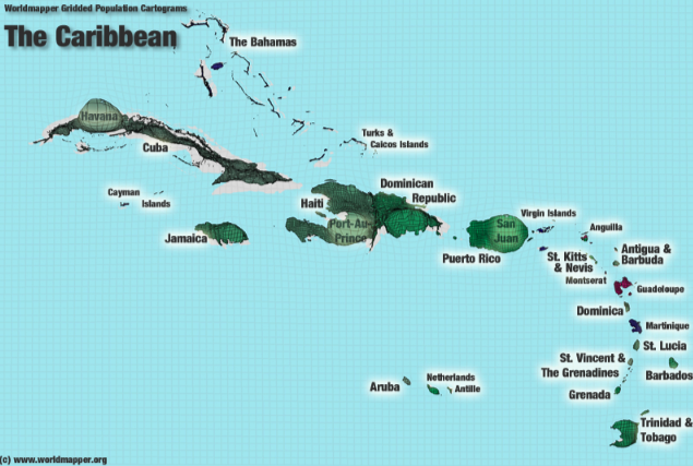
I continue to be a fan of the cartograms at world mapper. And I see they now have regional and national maps. For example here is one where the grid squares are proportional to the population across the Caribbean.
(with luck this will be the first posting done via the Postie plugin for WordPress, which pulls email (rich text in this case) via inserts it into your drafts, published, or whatever. You can grab a free email from one of these services, just be careful to get one with imap or pop3 support.)