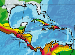
This map shows the risk of earthquakes for areas in the Caribbean.
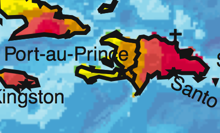
And this is the same map showing Haiti more closely
And this map shows where the first earthquake struck, and the following map shows one of the aftershocks. The capital city Port-a-Prince is labeled on the second map.
Those are ‘shake maps’, estimates of how severe the shaking was. The dark red is ten, or X, and here’s what the key says:
VIII - Drivers have trouble steering. Tall structures such as towers,
monuments and chimneys may twist and fall. Wood frame houses that
are not bolted to their foundations may shift and sustain serious
damage.  Damage is slight to moderate in well-constructed buildings,
considerable in poorly constructed buildings. Branches are broken and
fall from trees.  Changes occur in flow or temperature of springs and
wells. Cracks appear in wet ground and on steep slopes.

IX - Masonry structures and poorly constructed buildings suffer serious
damage or collapse. Frame structures, if not bolted, shift off
foundations. Serious damage to reservoirs.  Underground pipes broken.
Conspicuous cracks in the  ground. In alluvial areas, sand and mud
ejected and sand craters are formed.

X - Most masonry and frame structures destroyed along with their
foundations.  Some well-built wooden structures and bridges are
destroyed.  Serious damage to dams, dikes, and embankments. Large
landslides occur.  Water thrown on the banks of canals, rivers and
lakes.  Sand and mud shift horizontally on beaches and flat land.
Rails bent.
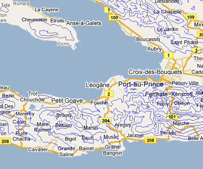
Those mountains are huge, four thousand feet. So the population is more densely packed than this map suggests.
You can see there is an extremely densely populated valley crossing the peninsula very close to the epicenter of the first quake. But that doesn’t really agree with this population map, which I tend to trust more since they care more about how population is actually distributed.
The contour lines, in blue, on this map, are at thousand foot intervals.
Ok, here is a profesional effort to estimate the population exposure. Click here to see the map.
As usual the Globe’s Big Picture has excellent coverage.
Shortly after Katrina NOAA took detailed arial photographs of the entire gulf coastline and put them up on the web. Does anybody knows of a similar effort for Haiti?


