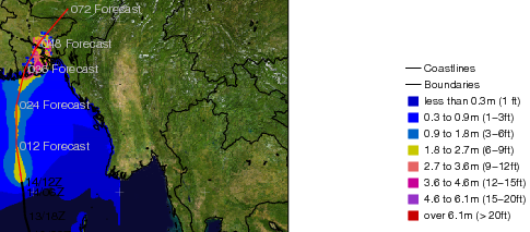
This is horrible. Tropical Cyclone Sidr is forecast to hit the low lying and extremely densely populated regions of Bangladesh. The track shown at right will bring the worst, right side, of the storm over the area. The storm is currently a category 4, and is forecast to weaken a bit before striking.
This is an amazingly densely populated region. The next map shows the low lying areas in reds, and those over 10 meters above sea level in green. The deepest colored areas have over a thousand people per square kilometer. Dhaka, the urban center here, holds 12 million people.
This next chart shows the forecasted storm surge, i.e. the water pushed in front of the storm. It’s small but the only comfort to be had is the storm surge isn’t 10 meters, but only 4-5.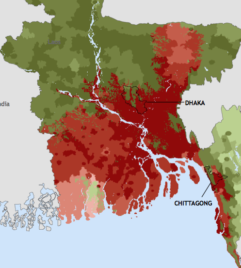
This is extremely similar to the cyclone in 1970 that killed a half a million people, lead to a civil war, and the founding of Bangladesh (formerly part of Pakistan).
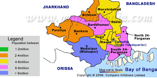
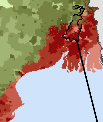
Finally this next map shows the population of West Bengal, the area of India that borders Bangladesh. This area includes Kolkata, the planet’s eight largest urban area (14 Million people). The next map is like the the one above, but for West Bengal, with the outlined area showing Kolkata.